Guam Landmarks
Guam has an ancient history and rich cultural heritage. Guam landmarks spanning Guam’s history from ancient times (2,000 BC) and extending through Spanish, American and Japanese occupations may be found across the island. There are currently 118 Guam historical sites listed on the U.S. National and 155 sites on the on the Guam Register of Historical Sites. Historical parks, statues, sites relating to Chamorro culture and legends and scenic overlooks are scattered all over the island. Most are free to the public. We attempt to provide a brief overview of some of the better known landmarks. Click on a thumbnail for a larger image. Get a map from your hotel, rental car company, or the Guam Visitors Bureau and visit these and many more sites.
Ancient Guam
 Latte stones are the most recognizable of all Guam landmarks as well as the other Northern Marianas islands. Latte stones are found nowhere else in the world and have become a signature of Guam and the Northern Marianas Islands. Replicas of latte stones may be seen all over the island. The latte stone shape appears on many logos of Guam organizations and local businesses.
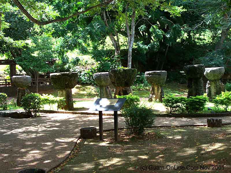 Latte Stone Park
Latte Stone Park. Latte stones are the pillars on which ancient Chamorro houses were constructed as early as 500 AD. Original Latte Stones were comprised of two pieces, a supporting column (halagi), made from coral limestone, and topped with a capstone (tasa), made from coral heads which were usually carried several miles from the quarry site or reef to the house. Bones of ancient Chamorros and their possessions, such as jewelry or canoes, were buried below the stones. Latte Stones are respected and are untouched. Human interlopers at Latte sites may encounter Taotaomoa, or ancestral Chamorro spirits. Many Latte sites can be found in Northern Guam. Replicas and images of Latte Stones are seen all around the Marianas. Stones in Latte Stone Park in Hagatna were transferred from their original location Guam’s Southern interior.
Guam Landmarks – Spanish Era
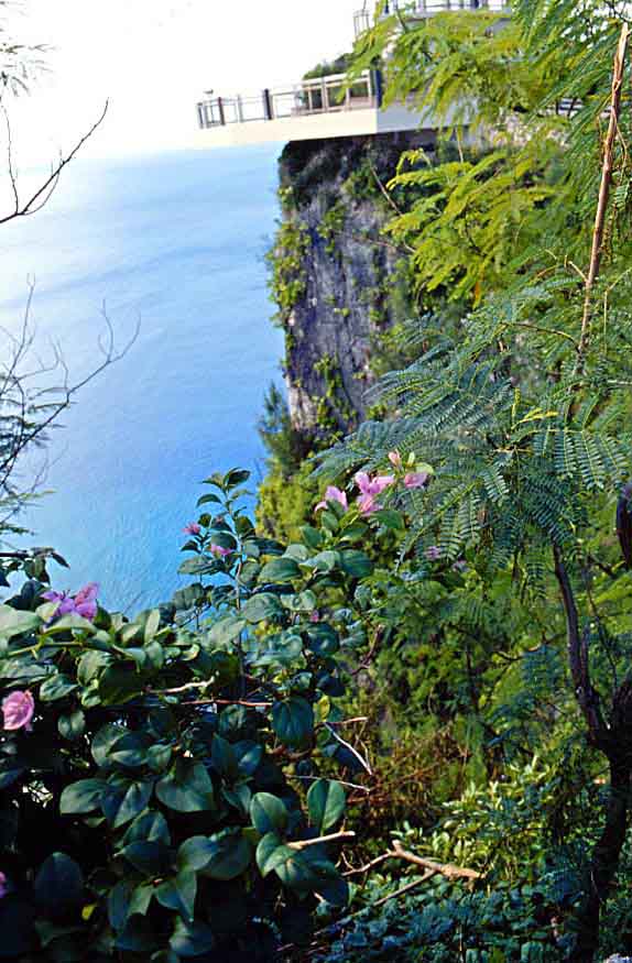 Two Lovers Point
Two Lovers Point. One of the better known Guam landmarks, Two Lovers Point, is perched atop a sheer cliff in central Guam overlooking Tumon Bay and the Philippine Sea. Two Lovers Point is the cliff from which, according to legend (Puntan Dos Amantes), two star crossed lovers plunged to their deaths rather than being separated when the Spanish Governor promised the girl to a Spanish Captain. As the legend goes, the daughter of a wealthy Spanish aristocrat and Chamorro mother, herself the daughter of great Chamorro chief, was promised, against her will, to a Spanish Captain. As the disillusioned daughter was walking along the beach, she met and fell in love with a young Chamorro man. When the father found out and demanded the daughter marry the Captain, she fled and met her lover near the cliff where they first met. The father told the Captain that she had been kidnapped and Spanish soldiers were sent to bring her and the man back. Trapped on the point, the two lovers tied their hair together and plunged to their deaths rather than being separated.
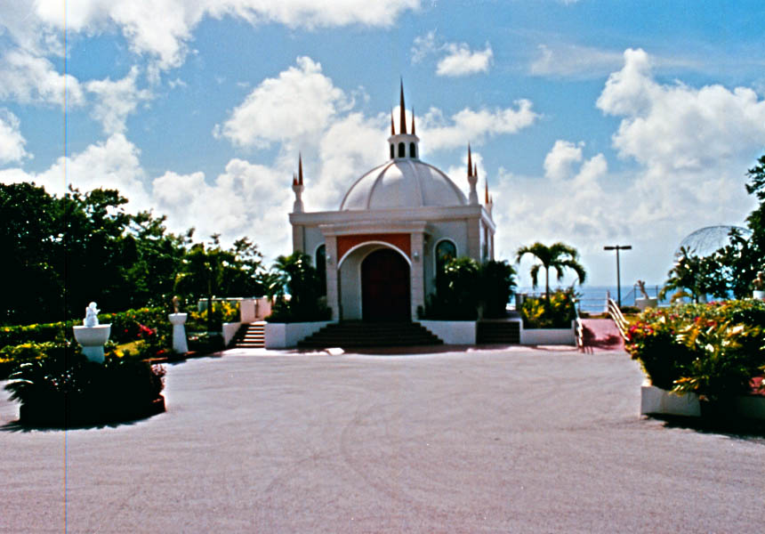 Wedding Chapel
Two Lovers Point features a souvenir shop and observation platform jutting out over the cliff that provides breathtaking views of the cliff and rocks below, Tumon Bay and the Philippine Sea. Tourist busses make regular runs and the Park is often bustling with Japanese and Korean tour groups. Guam is a popular wedding and honeymoon destination for Japanese and Korean couples. The wedding chapel on the cliff line at Two Lovers Point offers a magnificent view over the Philippine Sea.
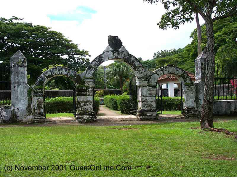 Plaza de Espana
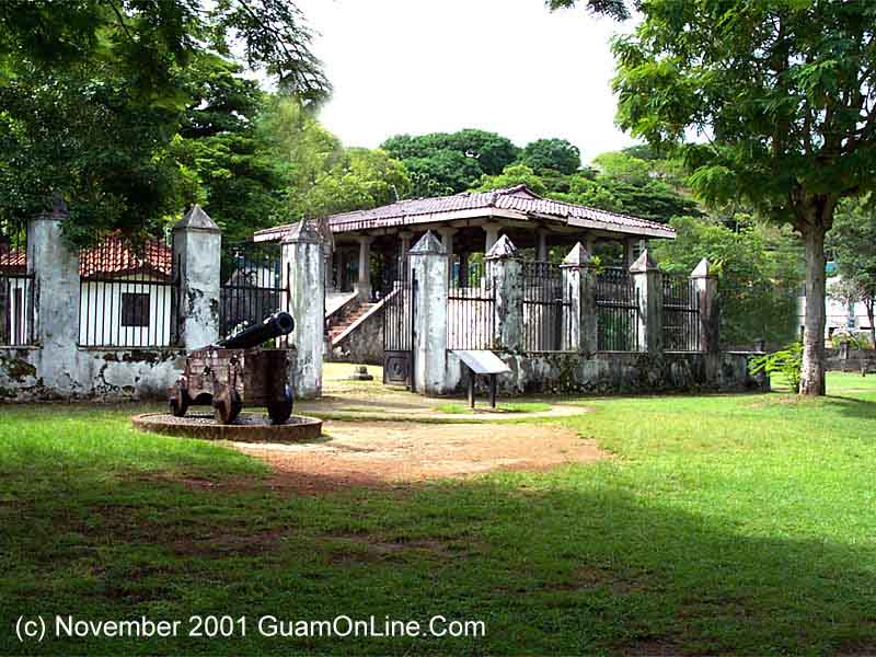 Plaza de Espana
Plaza de Espana. The Plaza de Espana was the courtyard of the Governor’s palace during The Spanish, American and Japanese occupations. The Chocolate House was the back porch and servants’ quarters. The palace was constructed in 1734. Most of the palace buildings were destroyed during the shelling of Hagatna in 1944 during the retaking of Guam in World War II. There are three structures still standing including the three-arch gate to Almacen (Arsena), the Azotea or back porch, and the Chocolate House.
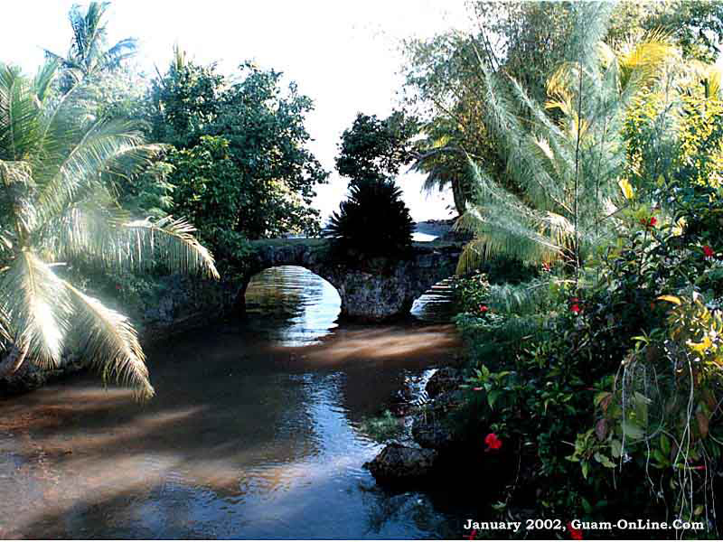
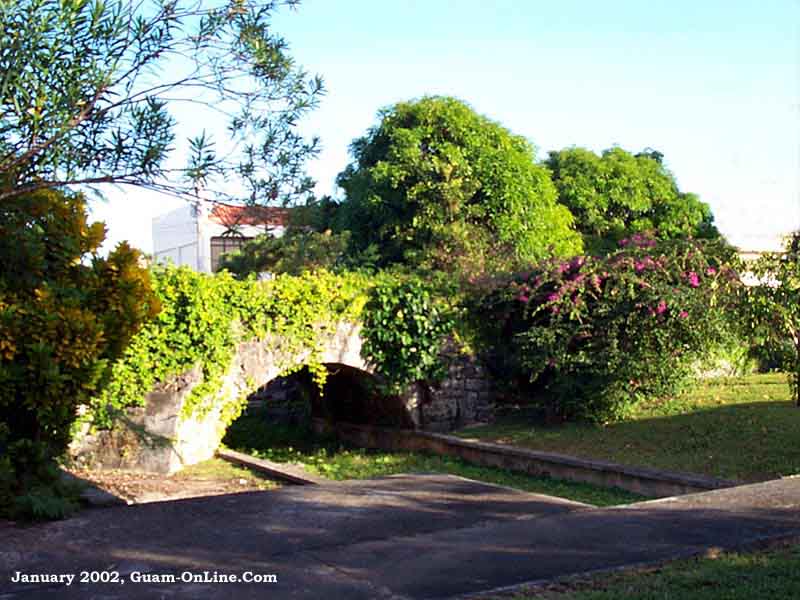 San Antonio Bridge
The San Antonio Bridge (To’lai Acho or stone bridge) was constructed of hand cut limestone and coral in 1800 to span the Hagatna River in what is now central Hagatna near the current Bank of Guam building. The bridge survived the shelling of Hagatna in World War II and continued in use after the War. During the rehabilitation of Hagatna that began in 1945, the river was filled but the bridge was spared and relocated to a small park on Marine Corps Drive across the road from the Hagatna Marina. The bridge was added to the National Register of Historic Places in 1974. On the side of the bridge facing the highway and marina is a relief of “Sirena the Mermaid”, a Legend of Guam culture.
 Tailafak Bridge
The Takifak Bridge (Taleyfak Tolaoi Acho) was constructed over the Talifak River on the El Camio Real coastal road linking Umatic to the Spanish capitol in Hagatna around 1866. The bridge still stands in it’s original location in Agat just South of Naval Base Guam and the Agat Marina. Driving South from Naval Base, about 1/4 mile past the Agat Marina, the road crosses over a small stream. This stream is the Talifak River. Look for the guardrails and the small mom-and-pop store just over the stream. The original Talifak Bridge sits between the road and the ocean about 30 feet away from the current road which was constructed farther away from the ocean.
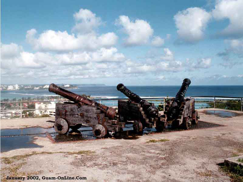 Fort Santa Augeda
Fort Santa Agueda. During the 1800’s, the Spanish constructed a number of forts to protect their claim and treasure galleons that made regular stops for replenishment of waters and rations. Spanish forts on Guam were not large rambling fortifications with internal living quarters and administrative facilities. Spanish forts on Guam were smaller fortified cannon emplacements with space for cannon and ammunition overlooking strategic approaches to the island. None of these forts in had living facilities. While some of the structures have deteriorated, others are well preserved.
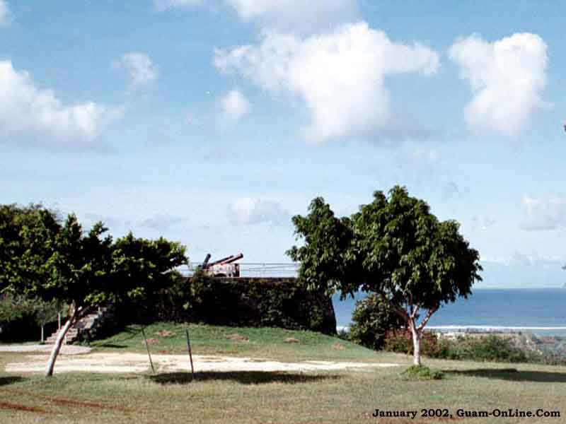 Fort Santa Agueda
Fort Santa Agueda was constructed in 1800 on the cliff line overlooking Hagatna Bay and the city of Hagatna. The cannon of Fort Agueda served to protect Hagatna harbor and the lucrative Galleon trade until the Spanish American War. The Spanish American war broke out in April 1898. In June, the American Frigate, USS Charleston steamed into Hagatna Harbor signaling they were attacking. The Spaniards were not aware the war had started and sent out a greeting party. The American Captain responded with a letter giving the Governor 30 minutes to surrender. The Governor took 29 minutes and Guam became a US possession without firing a shot. Today, Fort Santa Agueda’s cannons still point out over Hagatna Bay.
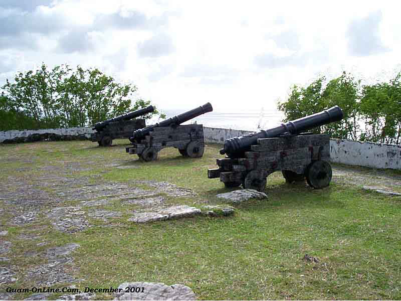 Fort Soledad
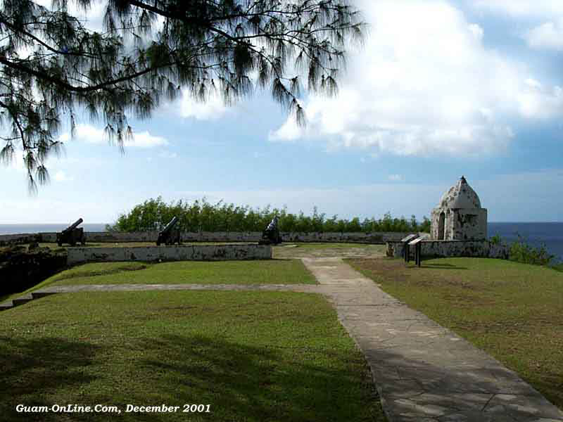 Fort Soledad
Fort Nuestra Senora de la Soledad. Fort Soledad was one of the last Spanish Forts on Guam constructed around 1802 to protect Spanish galleons making rest stops in Umatic Bay as they crisscrossed the Pacific between Manila and Mexico. Sitting on the cliff just to the South of Umatac, Fort Soledad has a commanding view of the Bay and all Ocean approaches. The Galleon trade ended in approximately 1819 after the Mexican Revolution. The Fort fell into disrepair, but was restored in 1995 and today the cannon of Fort Soledad still point out over the Pacific Ocean and Umatac Bay.
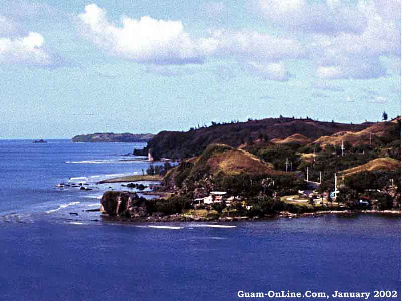 Fort Santo Angel
Fort Santo Angel. Fort Santo Angel was one of four Spanish forts in the Umatic area and the oldest still in existence. Perched on a rock on the Northwest tip of Umatic Bay, Fort Santo Angel served more as a watchtower than an armed fortification. Fort Soledad on the cliff on the Southern tip of bay provided the cannons to deter or destroy approaching ships. The fort has deteriorated. Today, all that remains are portions of some of the walls. A third and smaller lookout, San Jose, was constructed closer to the water’s edge on the Northern tip of Umatic as Fort Santo Angel started to deteriorate near the end of the Galleon era. By the 1850’s, both forts were in ruins.
 Sumay Cove
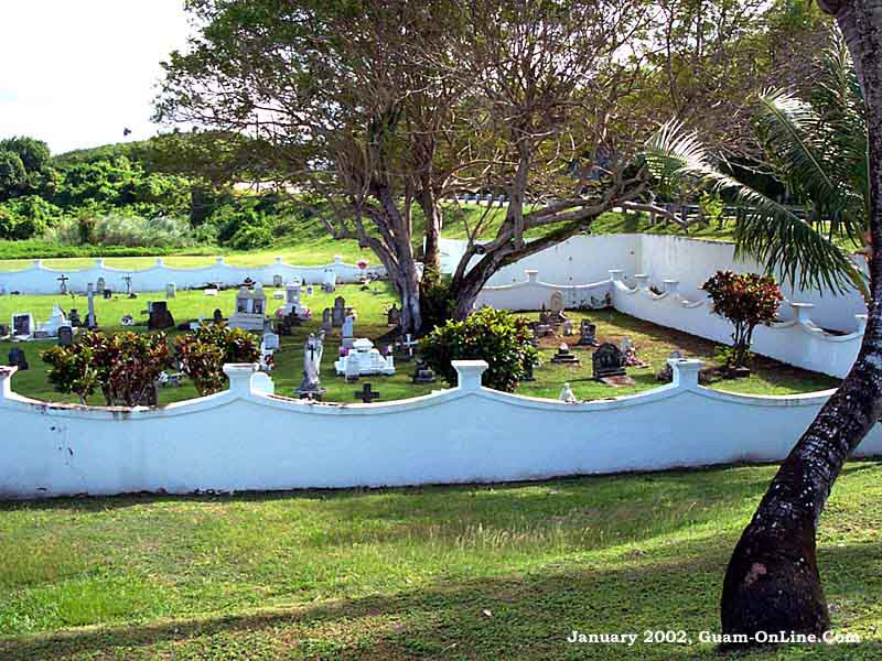
Sumay Cove Cemetery. During the later Spanish and early American administrations of Guam, Sumay Cove was a prosperous port and thriving seaside community, frequented by Spanish, French, German, Japanese, English, Russian and American ships. Sumay was the 2nd most populated village on Guam, next to Hagatna. When Japanese warplanes bombarded Guam in December 1941, Sumay was the first village attacked. The villagers fled into the nearby jungles and the village was virtually destroyed. After the War, the American military seized Sumay as part of the Naval Station. The natives were resettled in the surrounding hills and never allowed to return. All that remains of the original village is the Spanish occupation era cemetery. Headstones contain epitaphs in both Chamorro and Spanish. The oldest marker claims the year if birth as 1812 and year of death in the 1890’s.
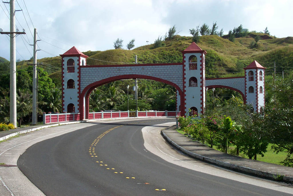 Umatic Spanish Bridge
Umatic Bridge. The Umatic Bridge lies on Guam Route 2 as it enters the Southern village of Umatic and Umatic Bay where Magellan’s fleet landed on Guam in 1521. During the early days of the Spanish era, Umatic Bay was the main port for the treasure Galleons that stopped in Guam as they sailed from the Philippines to Mexico. The Spanish constructed the El Camio Real coastal road in the late 1700’s to transport supplies between Hagatna and Umatic. Route 2 currently tracks the path of the old coastal road, but normally a little further from the shore to accommodate car and truck traffic. The current bridge was opened in October 1986. The bridge design reflects a Spanish architectural flavor with towers meant to symbolize the island’s Chamorro-Spanish Heritage.